


New satellite weather station inaugurated in Valais
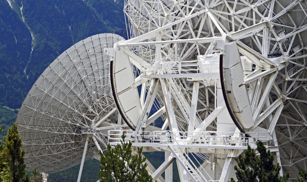
In Leuk (Canton Valais), the new satellite reception station in cooperation with EUMETSAT was inaugurated in the presence of Federal Councillor Alain Berset. At the end of 2022, the first satellite of the third generation of European satellites (Meteosat Third Generation) will be placed in orbit around the Earth, which will help to provide even more accurate weather forecasts and warnings.
In Leuk, Federal Councillor Alain Berset emphasised the importance of international technical and scientific cooperation in the operation of meteorological satellites and highlighted the crucial role of the European Organisation for the Exploitation of Meteorological Satellites (EUMETSAT) and its task of making the data collected by meteorological satellites available to member countries.
Web-site ESA – The European Space Agency (in english)
Meteorological satellites provide information on the evolution of cloud cover, the concentration of water vapour in the atmosphere and temperature and humidity profiles, thus playing a decisive role in the development of weather forecasts, the improvement of severe weather warnings and the study of climate change.
The latest generation of weather satellites, which will be launched at the end of 2022, promises new opportunities for the development of innovative meteorological and climatological data and products. In the future, satellite data will make it possible to monitor the activity of thunderstorms in a matter of seconds, to optimise the potential use of solar energy and, for example, to verify the quality of numerical weather forecast models.
In order to be able to benefit from all these advantages, the capacity for receiving and processing data needs to be significantly increased: the amount of data will be more than ten times greater than today. With three 6.5-metre diameter antennas and state-of-the-art technology standards, the station will receive a huge amount of data containing meteorological information every minute from the time the first satellite goes into orbit and transmit it to the EUMETSAT headquarters in Darmstadt, Germany.
EUMETSAT
After the satellite data are acquired, they are transmitted to the EUMETSAT headquarters in Darmstadt (D) where they are calibrated, georeferenced and then distributed to users, mainly national meteorological services and private weather service providers. After further processing, MeteoSwiss provides various satellite products to its internal and external customers, such as forecast services, automatic nowcasting systems, climate researchers or the media.
MeteoSwiss provides updated satellite images of cloud distribution every 15 minutes free of charge under Measurement Values. Under Service & Publications you can obtain many more satellite images for a fee. These can be specially adapted to your viewing requirements and are available with a time resolution of up to 5 minutes.
Satellite observations increasingly important
EUMETSAT‘s tasks include the operation of meteorological satellites as well as the provision of observation data and related services to all members. The Agency is also active in researching new applications for meteorological satellites and expanding the services offered. The development and construction of new satellites and measuring instruments requires cooperation with other institutions. For example, EUMETSAT cooperates intensively with the European Space Agency (ESA) for the construction of satellites.
Satellite observations
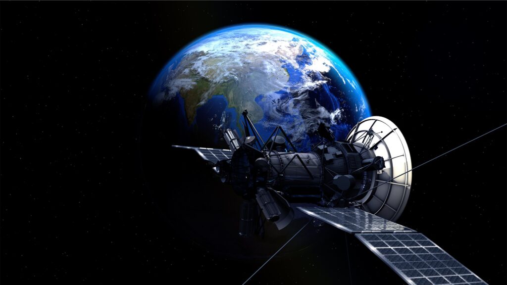
Meteorological satellites play a central role in meteorology as they make it possible to follow weather processes in the atmosphere 24 hours a day and on a global scale. MeteoSwiss receives satellite data from EUMETSAT, a consortium of European countries that jointly operates Meteosat and other meteorological satellites.
Satellite observations are of crucial importance for the preparation of weather forecasts. Geostationary satellites provide an accurate picture of the weather for very large areas of the Earth, virtually in real time. Meteorological satellites acquire data every few minutes, which makes it possible to continuously follow changes in the atmosphere. Satellite data are used by our meteorologists to get an overview of the weather situation. These data are also used in automatic short-term forecasting systems and are essential for the initialisation of the numerical model. Satellite meteorology is also gaining importance worldwide in terms of observing climate variables.
Meteosat Second Generation (MSG)
MeteoSwiss mainly uses measurements from Meteosat Second Generation (MSG) satellites. The main MSG satellites are located in geostationary orbit at an altitude of 36,000 km above the intersection of the equator and the meridian of Greenwich.
From this position, an MSG satellite can observe approximately one third of the globe. The main instrument of the second Meteosat generation is a multispectral camera called SEVIRI (Spinning Enhanced Visible and InfraRed Imager) which has twelve channels (8 infrared, 1 near infrared and 3 visible). One MSG satellite observes the entire visible earth disc from this position and takes a measurement every 15 minutes. A second satellite focuses on the northern third of the Earth’s visible disc and can thus make observations of Europe and the North Atlantic every 5 minutes. When the satellite data are displayed in the form of images, they allow the human eye to detect different cloud layers and other phenomena, such as the Sahara dust transport or, thanks to the combination of different channels, ash clouds from volcanoes.
Meteosat Third Generation (MTG)
Starting in 2023, the next generation of geostationary satellites will be launched into space with new instruments capable of observing the Earth with increased precision.
The MTG constellation will consist of four imaging camera satellites (MTG-I) and two satellites equipped with atmospheric survey instruments (MTG-S). The MTG-I is equipped with the Flexible Combined Imager (FCI), which is a further development of the SEVIRI instrument. FCI has 16 spectral channels (SEVIRI 12), the spatial resolution in the infrared range is 2 km, in the visible range 1 km (most SEVIRI channels have a resolution of 3 km). The first satellite will acquire an image of the visible disc of the Earth every 10 minutes. A second satellite will observe the upper quarter of the globe every 2.5 minutes. This satellite will acquire four channels with twice the spatial resolution, which will enable it to observe rapidly developing thunderstorms with great precision. MTG-I also has a new type of instrument on board, the Lighting Imager (LI), which for the first time will allow lightning activity in Europe to be recorded from space. The MTG-S atmospheric survey mission will have two spectrometers. The infrared spectrometer (IRS) measures temperature and humidity profiles, while the UVN spectrometer is designed to monitor air quality and the chemical composition of the atmosphere.