Melting glaciers shift the border between Italy and Switzerland
The two countries have reached an agreement to revise the border that separates them, made necessary by melting glaciers.
The border with Switzerland has remained largely unchanged over the last two centuries. As early as the beginning of the 19th century, during the Napoleonic era, borders were established between Switzerland, the Kingdom of Sardinia and the Italian territories under the Austrian Empire. With the unification of Italy in 1861, the border separating Switzerland from the pre-unification states officially became the border between the two countries, which has remained unchanged to this day.
In recent decades, Alpine glaciers have suffered significant mass loss, revealing areas previously covered by ice. This phenomenon not only alters the natural landscape, but also has diplomatic and economic implications. Some mountain huts and ski facilities are now located in areas that may fall under different jurisdictions, requiring negotiations between Italy and Switzerland for the management of these infrastructures.
The hydroelectric turbine for rivers which will revolutionize energy production
From the Old to the New Frontier
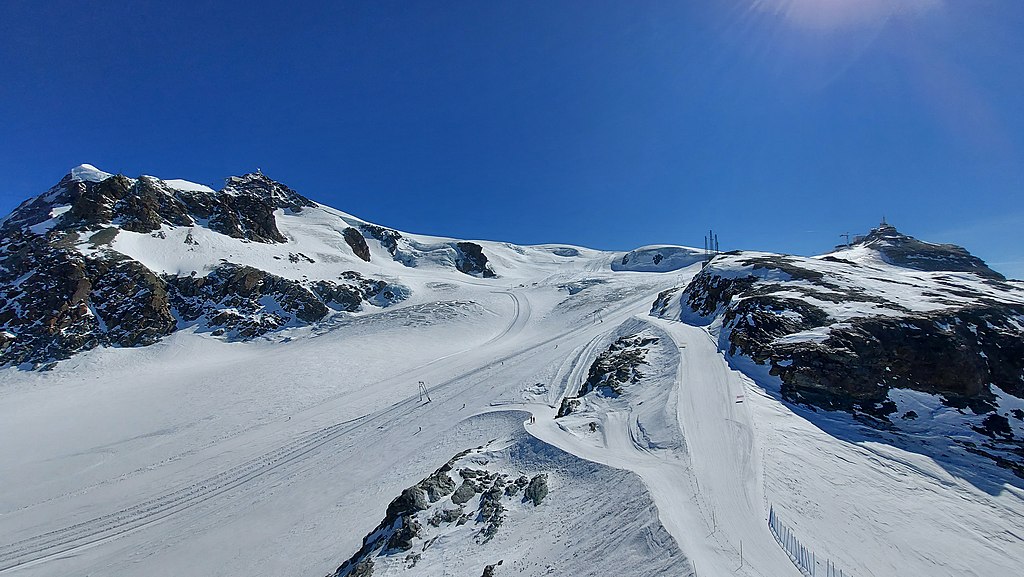
As stated by the Federal Office of Topography and enshrined in the 2008 agreement between Italy and Switzerland, the concept of the border in the Alps is fluid. The demarcation line is established on the basis of the direction of water flow and, for about 40 per cent of the 594 kilometres of the watershed, lies on glaciers and snow fields that are subject to continuous change over time.
As a rule, the boundary lines between the two countries are located in remote, hard-to-reach areas, which makes their relocation unproblematic. However, in 2019, the relocation of the Matterhorn Guide Hut, located between the Aosta Valley and the Canton of Valais, raised some controversy. Built in 1984 in Italy, the hut was moved to Switzerland due to the retreat of the Teodulo Glacier, which lost almost a quarter of its mass from 1973 to 2010 and changed the geography of the ridge and thus the border line.
Another example is the Gallo Artificial Lake, also known as Livigno Lake, the northern side of which lies in the municipality of Zernez (Canton of Graubünden), while the southern side bathes the Lombard town of Livigno. The same situation applies to the Val di Lei, also in the province of Sondrio, and a small portion in the Hinterrhein, also in the Canton of Graubünden.
An Evolving Border
The border between the Italian Republic and the Swiss Confederation stretches 744 kilometres, from Monte Dolent in the west (a border point also shared with France) to Piz Lat in the east (where it also meets Austria). In addition to the main border, there is a smaller border surrounding the municipality of Campione d’Italia, an Italian exclave located within Swiss territory and included within the total 744 kilometres.
Italy and Switzerland reached an agreement to change the border at the foot of the Matterhorn due to melting glaciers. This phenomenon has caused significant changes in the historical demarcation lines, making a new mapping necessary. The borders, once delineated by ridges and perennial snows, are thus being transformed in response to ongoing climate change. The recent agreement includes boundary changes in areas such as the Testa Grigia, the Carrel Refuge and the Rollin Hump.